LodestarGIS — property maps, reports, and CAD exports for land decisions in British Columbia and the United States

The boundary, the water, the terrain, and the records that govern them — assembled into one set of sheets you can hand to a designer, a lender, or a contractor.

Built on the public record — ParcelMap BC, GWELLS and DataBC in British Columbia; USGS 3DEP, 3DHP and USDA SSURGO across the United States.

The foundation

Built on the public record

Public records, one instrument

The same records a diligence search would pull — from the province in BC, from federal survey programs in the US — assembled into one instrument instead of a dozen browser tabs.

British Columbia

  • ParcelMap BC

    the legal parcel fabric — your boundary as the province records it

  • GWELLS

    registered water wells and mapped aquifers, with depths and distances

  • DataBC · LidarBC

    ALR standing, biogeoclimatic zone, hydrology, roads, and bare-earth lidar

United States

  • USGS 3DEP

    bare-earth lidar and seamless elevation, nationwide

  • USGS 3DHP

    the national hydrography layer — flowlines and waterbodies

  • USDA SSURGO

    soil survey, including drainage class

Verified before it ships

Every report is checked by software against the source records before a human ever sends it. Wrong numbers don’t leave the shop.

  1. 01Acquire

    Public records pulled fresh for your parcel — never from a stale cache.

  2. 02Interpret

    Raw records distilled into plain language a buyer can act on.

  3. 03Cross-check

    Software verifies every figure against the source before a human sends it.

  4. 04Package

    Map, report, and CAD file leave together, under one seal.

Where we work

Two jurisdictions, and we are specific about what each one gets. You find out which applies to your property before you order, not after.

British Columbia
Province-wide
Legal parcel boundaries anywhere in BC, from the province’s own cadastre.
United States
Terrain, water & soil nationwide
Federal elevation, hydrography and soil records cover the continental US today.
US parcel boundaries
County by county
Legal parcel lines come from each county’s own records. We onboard new counties on request — and we tell you which you’re in before you order.
Check your property

The package

One property, read three ways

Observe, analyze, intervene — the way a designer reads a site. Every sheet below is a real deliverable from a real property, not a mock-up, and every package is scaled to what your land actually holds.

01 · Observe

The Map Set

Up to ten sheets, one property.

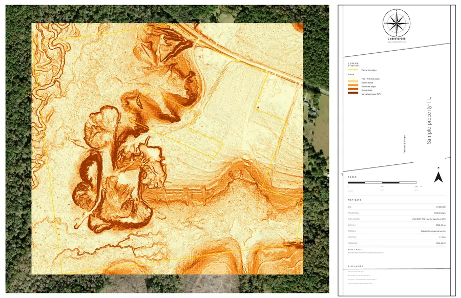
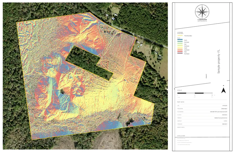
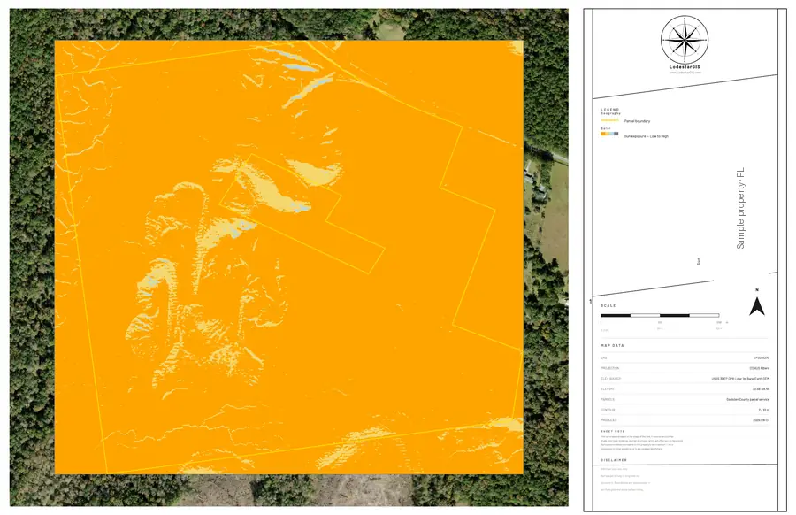
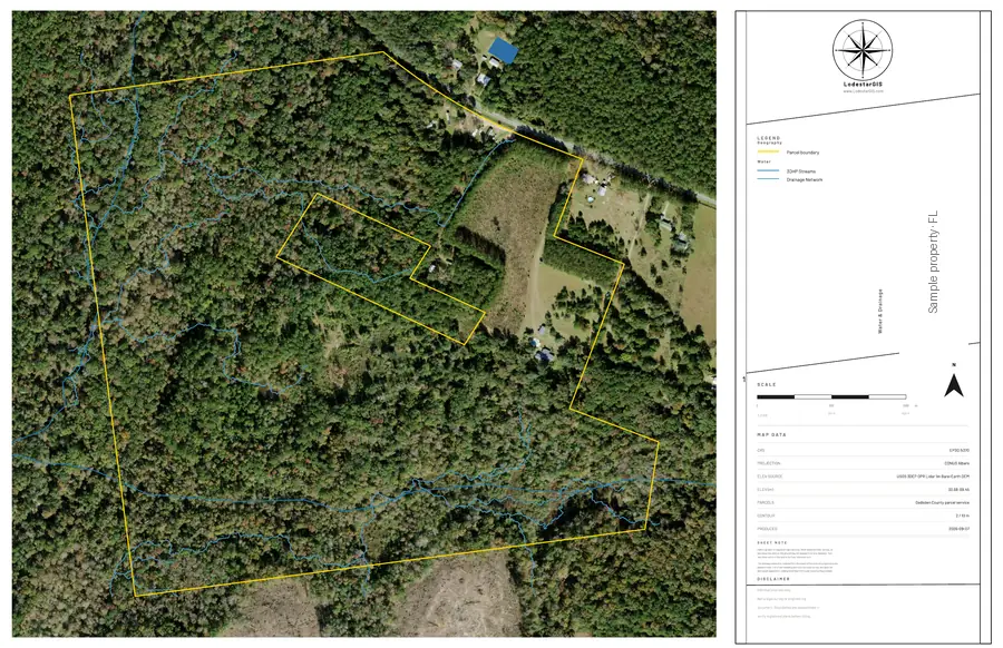
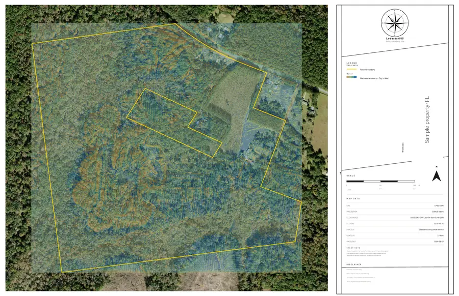
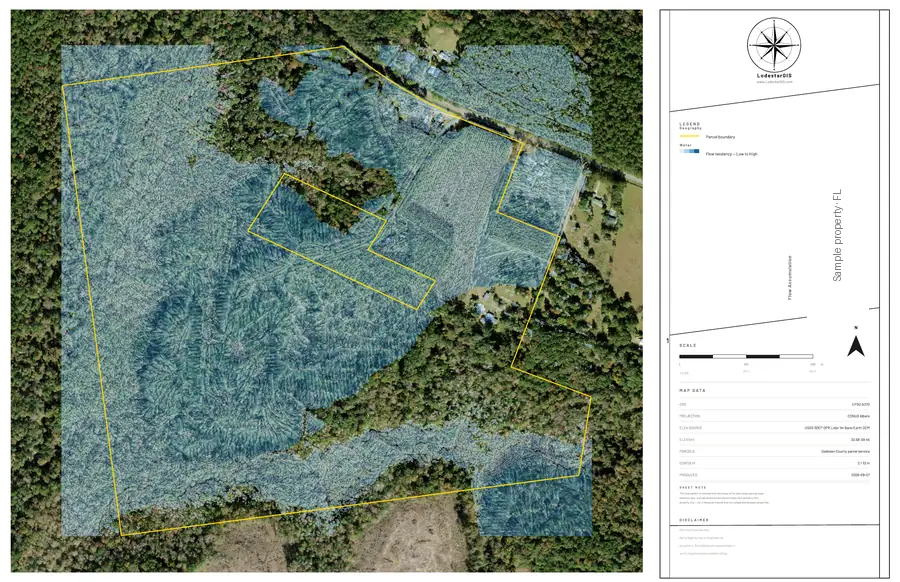
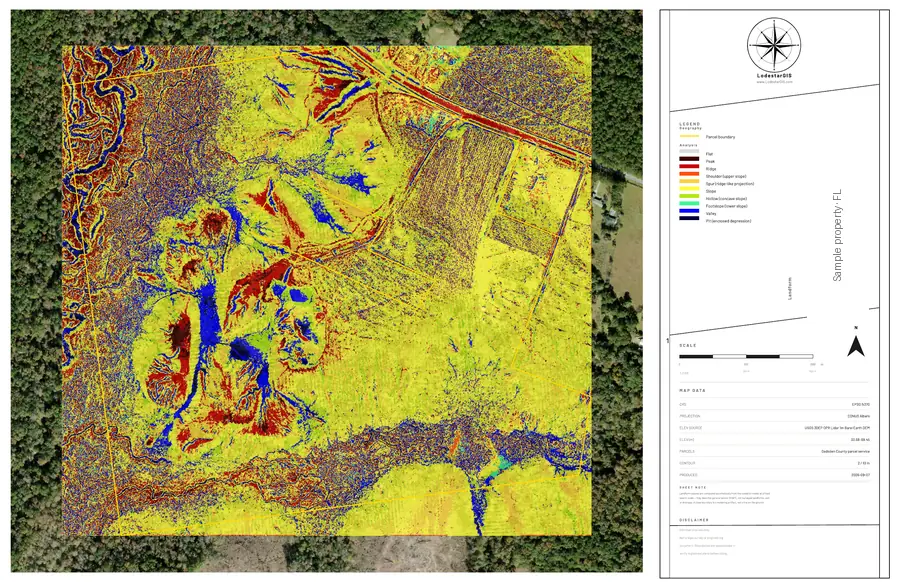
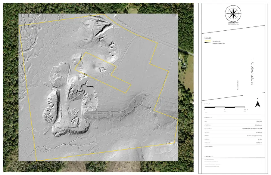
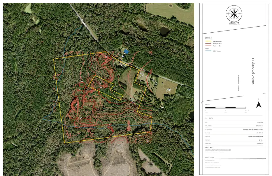
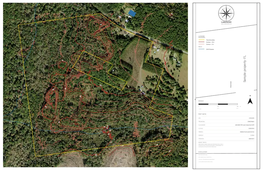
Not a map — a set. Each sheet isolates one behaviour of the land, drawn to survey convention over the current orthophoto, with the legal boundary carried through every one.

Overview sheet from a LodestarGIS map set: the parcel boundary over the current orthophoto, with a survey sidebar carrying legend, north arrow and data provenance.
Actual sheets from a delivered set — Gadsden County, Florida. Showing Overview, 1 of 10.

02 · Analyze

The Report

Up to twenty-seven pages, in five parts.

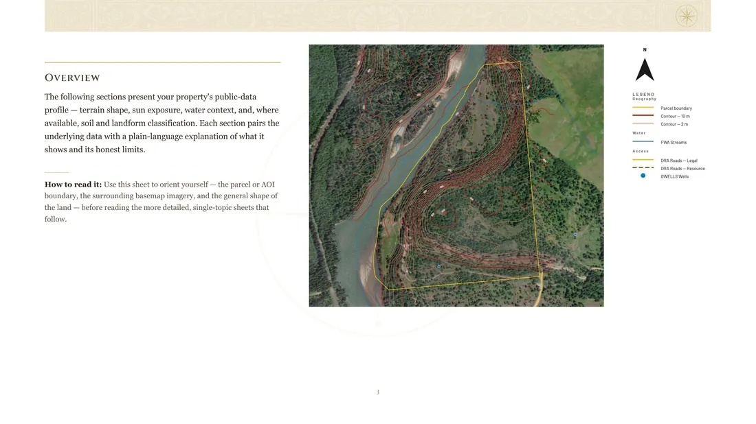
The sheets explained in plain language — what each layer shows, what it means for the property, and where the figure came from. Every section carries its own honest limits, and the deck reports what is actually there rather than padding to a page count.

  • Site and Setting
  • Terrain and Sun
  • Drainage and Land Shape
  • Ground and Context
  • Reference
A page from the LodestarGIS report deck: a plain-language section beside its map, with legend, north arrow and a note on how to read the sheet.
Actual report page from a delivered set — British Columbia.

03 · Intervene

The Exports

Build-ready geometry and data.

The same verified geometry as a layered DXF, georeferenced and drawn to real-world units — it drops straight into AutoCAD or Civil 3D, so your designer starts from the record instead of redrawing it. Georeferenced imagery and a lidar surface come with it.

  • Layered DXF
  • Georeferenced basemap imagery
  • LandXML TIN surface
The delivered DXF’s real linework — layer for layer.

Pricing

We read the land as one system — what is here, what it means, what you can build.

Priced in the open

Find your acreage, read the price. That is the price — not a starting point and not an estimate. It is a fraction of what a single site visit costs, and you will know what the land is before you commission one.

01

The Map Set

The full sheet set, drawn to survey convention off your legal parcel boundary — not a data summary.

  • Up to ten sheets
  • Legal boundary on every one
  • Current orthophoto
up to 20 acres
$395
over 20, to 160 acres
$495
over 160, to 640 acres
$695
over 640 acres
Quoted
Start with 01

02

Map Set + Report

Most chosen

Every sheet explained in plain language — what it shows, what it means, and where each figure came from.

  • Everything in 01
  • Up to twenty-seven pages
  • Honest limits, per layer
up to 20 acres
$695
over 20, to 160 acres
$895
over 160, to 640 acres
$1,295
over 640 acres
Quoted
Start with 02

03

The Full Package

Everything above, plus build-ready geometry your designer opens directly instead of redrawing.

  • Everything in 02
  • Layered DXF
  • Georeferenced imagery + lidar surface
up to 20 acres
$1,295
over 20, to 160 acres
$1,595
over 160, to 640 acres
$1,995
over 640 acres
Quoted
Start with 03

If your county has no published boundary yet

Approximate-boundary report

For properties whose county has not published a legal parcel boundary yet. The same sheets and the same interpretation, drawn on an approximate boundary.

No CAD export at this tier — an approximate boundary must never be handed to a designer as build geometry.

Check your property below — we’ll tell you which applies before anything is ordered.

up to 20 acres
$495
over 20, to 160 acres
$595
over 160, to 640 acres
$795
over 640 acres
Quoted

Three business days. Every set is drawn to convention and checked by a person before it reaches you. We would rather tell you that than pretend it happens the moment you click.

Priced in USD. We check your property before you pay. If we can’t produce what we promised, you aren’t charged. If a delivered set is missing a component we listed for your tier, tell us within 14 days and we’ll complete it or refund in full.

Sheet and page counts vary by property — by what is actually there, not by acreage. The deck reports what it finds and does not pad to a number: a quiet property gets a shorter report, and that is the honest result rather than a worse one. Properties well beyond ordinary size, and those where no legal parcel boundary is published, are quoted individually.

Professional or ordering for a client? Ordering for clients, or across a caseload? Professional and commercial pricing — volume rates from three properties a year, and redistribution rights for the deliverables you pass to a client — is arranged directly. Mark yourself as a professional in the form below and say what you need.

Before you order

Check your property

Tell us where the land is and we’ll confirm exactly what we can produce for it, and the exact price, before anything is ordered. A link to pay follows that confirmation — nothing is charged until you have the number in writing.

Designer, contractor, broker or lender? Same form — mark yourself as a professional and note your volume in the message. We’ll talk workflow.

The most precise address you have gives the best result. No address? Coordinates work too.

An estimate is fine — it sets your price band, and we confirm it against the real parcel before you pay.

Choose a province or state, and a county where we ask for one, and the packages your property supports will appear here.

We use your address only to check coverage and produce your report. We don’t sell it, and we delete enquiry data that doesn’t become an order within 12 months. See our terms and guarantee.